
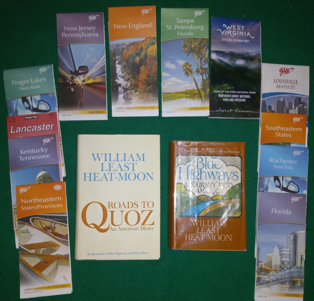
“Nonetheless, for me, twenty-five square inches of pixels cannot deliver the same sense of location as can fifteen-hundred square inches of paper road map – a document capable of suggesting a traveler’s place in a greater landscape embracing heart and soul.”
William Least Heat-Moon, Roads to Quoz
In this day of electronic mapping software that can be accessed on a computer, tablet, cell phone, and even our automobiles the paper map can be seen as an anachronism. It could even be compared to the typewriter of Victrola as a product of a by-gone age. I have even heard it said that no one needs a paper map, there are too many other resources available for travel. I would argue, along with author William Least Heat-Moon (who also wrote my favorite travel book, Blue Highways), that a paper map is indispensable for planning and taking a road trip. The electronic versions are useful, but cannot replace the much wider overview provided by a paper map.
Map reading and compass use are critical skills in a wilderness area. In this environment there may not be a signal available for a cell phone and we will certainly not find an “electricity bush” for recharging a GPS in the backcountry. In this situation, a paper map has no equal. The ability to read a map and use a compass is a necessary survival skill set when going into wild places.
Sometimes in the cold short days of winter I occupy myself by looking at paper maps. It does not matter if the maps are recent or are of historic vintage. The historic maps can often be more interesting, and certainly show a different view than we see today. Book comprised of reproductions of ancient maps can fill hours with contemplation, thought, and wonder. The old maps can be like a time machine that you can hold in your hands, giving insight into the ideas and actions of people from a time long ago (however you measure “long ago”).
Paper maps can reveal so much about a travel route, a region, or even a country. At one time, they were widely available and used, even to the point of being given away for free at many gas stations. Now it seems that paper maps are only available from travel organizations or interstate highway travel centers near the meeting of two state borders. Even in those cases the maps may no longer be free.
Sadly, the skill of reading paper maps may also be disappearing. Many people much younger than I admit to not being able to read a paper map. And the cardinal points of a compass are reduced to a letter written in glowing pixels on a vehicle dashboard. No matter, I will continue with my anachronistic ways and attempt to teach the skills necessary to read a paper map and use a compass. The joys of paper map reading are held deeply within my being and I hope the skills will continue long after I am gone.